
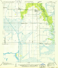
1934 Map of Latania Lake
USGS Topo · Published 1961About this map
The Intracoastal Waterway cuts a straight path across the coastal marshlands of Cameron Parish in this mid-1930s topographical study. This landscape is defined by its complex hydrology, where the Mermentau River and Bayou Lacassine weave through an expansive wetland system that includes Grand Lake, Lake Misere, and Latania Lake. Small elevations like Latania Hill and Onion Hill provide the only vertical relief in a terrain dominated by Maple Marsh and various water cutoffs.
Find a feature on this map
27 named features on this map. Tap any name to fly to it.
Don’t see what you’re looking for? This feature index may not catch every label — zoom into the map to look around manually.
Map Details
Editions of this 1934 Latania Lake Map
This is the sole edition of this map. No revisions or reprints were ever made.
Other maps of this area

1934 · Catfish Lake
USGS Topo · 1:24,000

1934 · Lake Misere
USGS Topo · 1:24,000

1935 · Lake Misere
USGS Topo · 1:31,680

1935 · Catfish Lake
USGS Topo · 1:31,680

1935 · Latania Lake
USGS Topo · 1:31,680

1935 · Grand Chenier
USGS Topo · 1:31,680

1946 · Lake Arthur
USGS Topo · 1:31,680

1946 · Hayes
USGS Topo · 1:31,680

1947 · Thornwell
USGS Topo · 1:31,680
1949 · Hayes
USGS Topo · 1:31,680