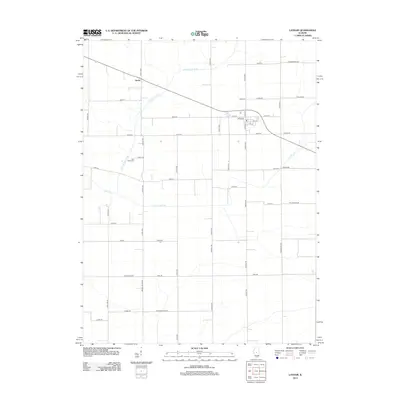
2012 Map of Latham
USGS Topo · Published 2012About this map
Latham serves as the central hub of this central Illinois landscape, showing a grid of residential streets including N Main St and S Main St alongside local landmarks like Laenna Lake. The surrounding countryside is defined by the hydrologic network of the Lake Fork, where the N Fork Lake Fork and S Fork Lake Fork converge into the main branch of the Lake Fork. This drainage system dictates the placement of early infrastructure and local heritage sites, such as the Lake Bank Cem located just west of 2000th Ave. To the northwest, the small settlement of Narita sits along the roadway, while a dense network of county roads like Poland Rd and W Hampshire Rd connects the scattered farmsteads that characterize this agricultural region during the early 21st century.
Find a feature on this map
51 named features on this map. Tap any name to fly to it.
Don’t see what you’re looking for? This feature index may not catch every label — zoom into the map to look around manually.
Map Details
Editions of this 2012 Latham Map
This is the sole edition of this map. No revisions or reprints were ever made.
Other maps of this area

1911 · Lincoln
USGS Topo · 1:62,500

1913 · Lincoln
USGS Topo · 1:62,500

1954 · Niantic
USGS Topo · 1:62,500

1954 · Mechanicsburg
USGS Topo · 1:62,500

1957 · Kenney
USGS Topo · 1:62,500

1958 · Peoria
USGS Topo · 1:250,000

1958 · Decatur
USGS Topo · 1:250,000

1961 · Peoria
USGS Topo · 1:250,000

1961 · Decatur
USGS Topo · 1:250,000

1963 · Peoria
USGS Topo · 1:250,000