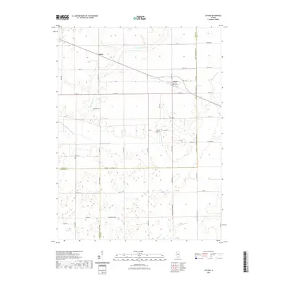
2021 Map of Latham
USGS Topo · Published 2021About this map
The agricultural landscape of Latham and Narita is defined by a dense network of country roads and the meandering drainage of the Lake Fork system. This 2021 survey shows the convergence of Logan, Macon, and Sangamon counties, a region where the land's utility is etched into its rectilinear grid. Local history is anchored at the Lake Bank Cem and Two Mile Grove Cem, which serve as quiet landmarks among the expansive fields. The hydrology of the area is distinct, with the S Fork Lake Fork and N Fork Lake Fork converging near Laenna Lake, while Willow Br drains the southern portion of the quadrangle. Significant survey markers like the N Third Principal Meridian Rd provide a structural baseline for the local geography, illustrating how early nineteenth-century land surveys continue to dictate the modern road network and property boundaries of Central Illinois.
Find a feature on this map
58 named features on this map. Tap any name to fly to it.
Don’t see what you’re looking for? This feature index may not catch every label — zoom into the map to look around manually.
Map Details
Editions of this 2021 Latham Map
This is the sole edition of this map. No revisions or reprints were ever made.
Other maps of this area

1911 · Lincoln
USGS Topo · 1:62,500

1913 · Lincoln
USGS Topo · 1:62,500

1954 · Niantic
USGS Topo · 1:62,500

1954 · Mechanicsburg
USGS Topo · 1:62,500

1957 · Kenney
USGS Topo · 1:62,500

1958 · Peoria
USGS Topo · 1:250,000

1958 · Decatur
USGS Topo · 1:250,000

1961 · Peoria
USGS Topo · 1:250,000

1961 · Decatur
USGS Topo · 1:250,000

1963 · Peoria
USGS Topo · 1:250,000