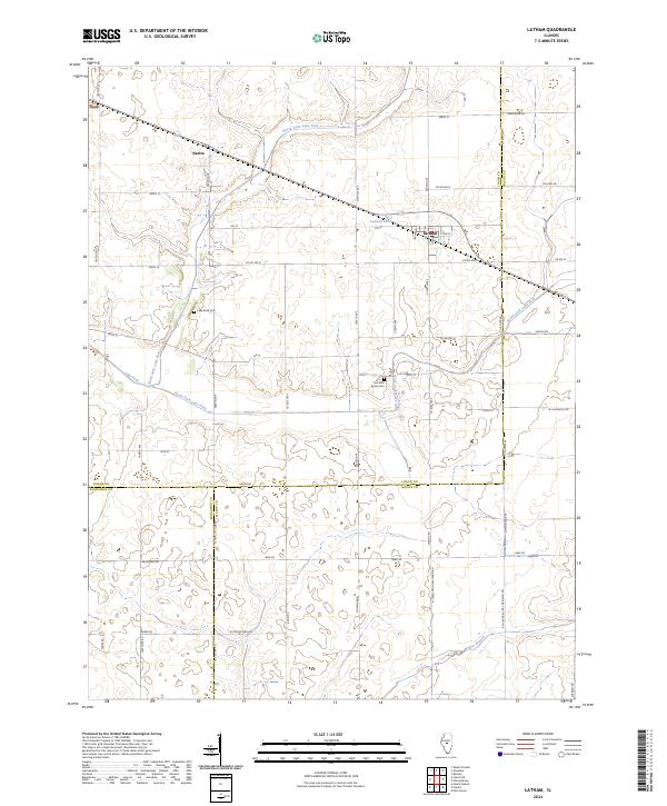
2024 Map of Latham
USGS Topo · Published 2024About this map
Latham serves as the primary population center in this Central Illinois landscape, situated near the intersection of the Logan and Macon county lines. The area is defined by a dense grid of agricultural roads, including N Third Principal Meridian and N Meridian Ave, which reflect the systematic land divisions of the region. The waterways of North Fork Lake Fork and South Fork Lake Fork converge here to form Lake Fork, creating a drainage network that dictates the placement of early settlements and rural infrastructure. Local genealogy is anchored by established burial grounds like Lake Bank Cem and Two Mile Grove Cem, while smaller locales such as Narita and the waters of Laenna Lake provide further points of historical reference for the rural community.
Find a feature on this map
55 named features on this map. Tap any name to fly to it.
Don’t see what you’re looking for? This feature index may not catch every label — zoom into the map to look around manually.
Map Details
Editions of this 2024 Latham Map
This is the sole edition of this map. No revisions or reprints were ever made.
Other maps of this area

1911 · Lincoln
USGS Topo · 1:62,500

1913 · Lincoln
USGS Topo · 1:62,500

1954 · Niantic
USGS Topo · 1:62,500

1954 · Mechanicsburg
USGS Topo · 1:62,500

1957 · Kenney
USGS Topo · 1:62,500

1958 · Peoria
USGS Topo · 1:250,000

1958 · Decatur
USGS Topo · 1:250,000

1961 · Peoria
USGS Topo · 1:250,000

1961 · Decatur
USGS Topo · 1:250,000

1963 · Peoria
USGS Topo · 1:250,000