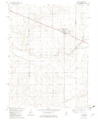
1982 Map of Latham
USGS Topo · Published 1983About this map
Latham serves as the primary hub of activity in this rural landscape near the intersection of the Third Principal Meridian. The town is bisected by the Illinois Central Gulf railroad, which runs through the heart of the settlement past a Nursing Home and Sew Disp Ponds toward Laenna Lake. The surrounding farmland is divided into large townships such as Laenna and Lake Fork, with the small community of Narita situated in the northwest along the North Fork of the Salt Creek drainage system.
Find a feature on this map
24 named features on this map. Tap any name to fly to it.
Don’t see what you’re looking for? This feature index may not catch every label — zoom into the map to look around manually.
Map Details
Editions of this 1982 Latham Map
This is the sole edition of this map. No revisions or reprints were ever made.
Other maps of this area

1911 · Lincoln
USGS Topo · 1:62,500

1913 · Lincoln
USGS Topo · 1:62,500

1954 · Niantic
USGS Topo · 1:62,500

1954 · Mechanicsburg
USGS Topo · 1:62,500

1957 · Kenney
USGS Topo · 1:62,500

1958 · Peoria
USGS Topo · 1:250,000

1958 · Decatur
USGS Topo · 1:250,000

1961 · Peoria
USGS Topo · 1:250,000

1961 · Decatur
USGS Topo · 1:250,000

1963 · Peoria
USGS Topo · 1:250,000