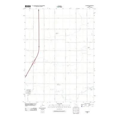
2010 Map of Latimer
USGS Topo · Published 2010About this map
Latimer sits in the southwestern corner of this Iowa landscape, where the Latimer Post Office serves the local community amid a grid of rural agricultural roads. The area is characterized by its numerous small burial grounds that reflect the ancestral heritage of the township, including Saint Pauls Evangelical Lutheran Cemetery, ZionReformed Cemetery, and Marion Center Cemetery. These sites, alongside Old Chapin Cemetery and Trinity Cemetery, provide valuable anchor points for genealogists tracing family histories in Franklin County.
Find a feature on this map
28 named features on this map. Tap any name to fly to it.
Don’t see what you’re looking for? This feature index may not catch every label — zoom into the map to look around manually.
Map Details
Editions of this 2010 Latimer Map
This is the sole edition of this map. No revisions or reprints were ever made.
Other maps of this area

1954 · Waterloo
USGS Topo · 1:250,000

1955 · Waterloo
USGS Topo · 1:250,000

1972 · Alexander
USGS Topo · 1:24,000

1972 · Thornton
USGS Topo · 1:24,000

1972 · Swaledale
USGS Topo · 1:24,000
1972 · Sheffield
USGS Topo · 1:24,000

1972 · Latimer
USGS Topo · 1:24,000

1972 · Hampton North
USGS Topo · 1:24,000

1979 · Dows East
USGS Topo · 1:24,000

1979 · Coulter
USGS Topo · 1:24,000