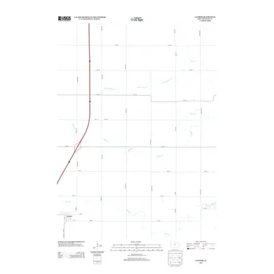
2013 Map of Latimer
USGS Topo · Published 2013About this map
The settlement of Latimer occupies the southwestern corner of this Iowa landscape, where a grid of rural roads such as Martin St and Gull Ave connects the small town to the surrounding agricultural prairie. This 2013 survey illustrates a landscape deeply shaped by drainage and hydrology, featuring the man-made Ditch Number 55 alongside natural watercourses like Otter Cr and Buffalo Cr. To the southeast, the waters of Spring Cr flow toward Beeds Lake, a localized water body that stands out against the rectangular township and range road network. The map reveals the precise spatial relationship between the town’s residential streets, like Polk St, and the essential waterways that define the drainage of this Franklin County region.
Find a feature on this map
28 named features on this map. Tap any name to fly to it.
Don’t see what you’re looking for? This feature index may not catch every label — zoom into the map to look around manually.
Map Details
Editions of this 2013 Latimer Map
This is the sole edition of this map. No revisions or reprints were ever made.
Other maps of this area

1954 · Waterloo
USGS Topo · 1:250,000

1955 · Waterloo
USGS Topo · 1:250,000

1972 · Alexander
USGS Topo · 1:24,000

1972 · Thornton
USGS Topo · 1:24,000

1972 · Swaledale
USGS Topo · 1:24,000
1972 · Sheffield
USGS Topo · 1:24,000

1972 · Latimer
USGS Topo · 1:24,000

1972 · Hampton North
USGS Topo · 1:24,000

1979 · Dows East
USGS Topo · 1:24,000

1979 · Coulter
USGS Topo · 1:24,000