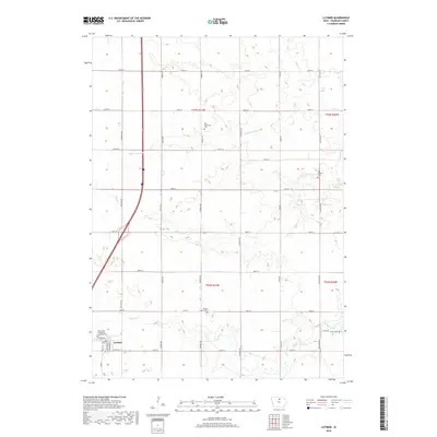
2018 Map of Latimer
USGS Topo · Published 2018About this map
Latimer serves as the primary hub in this portion of Franklin County, showing a well-organized street grid that includes W Main St and W South St. The surrounding landscape is defined by the high-precision management of its prairie waterways, with established drainages like Ditch Number 55 supplementing the natural courses of Otter Cr, Buffalo Cr, and Spring Cr. This network reflects a highly developed agricultural environment where topography and drainage are critical to the region's productivity.
Find a feature on this map
35 named features on this map. Tap any name to fly to it.
Don’t see what you’re looking for? This feature index may not catch every label — zoom into the map to look around manually.
Map Details
Editions of this 2018 Latimer Map
This is the sole edition of this map. No revisions or reprints were ever made.
Other maps of this area

1954 · Waterloo
USGS Topo · 1:250,000

1955 · Waterloo
USGS Topo · 1:250,000

1972 · Alexander
USGS Topo · 1:24,000

1972 · Thornton
USGS Topo · 1:24,000

1972 · Swaledale
USGS Topo · 1:24,000
1972 · Sheffield
USGS Topo · 1:24,000

1972 · Latimer
USGS Topo · 1:24,000

1972 · Hampton North
USGS Topo · 1:24,000

1979 · Dows East
USGS Topo · 1:24,000

1979 · Coulter
USGS Topo · 1:24,000