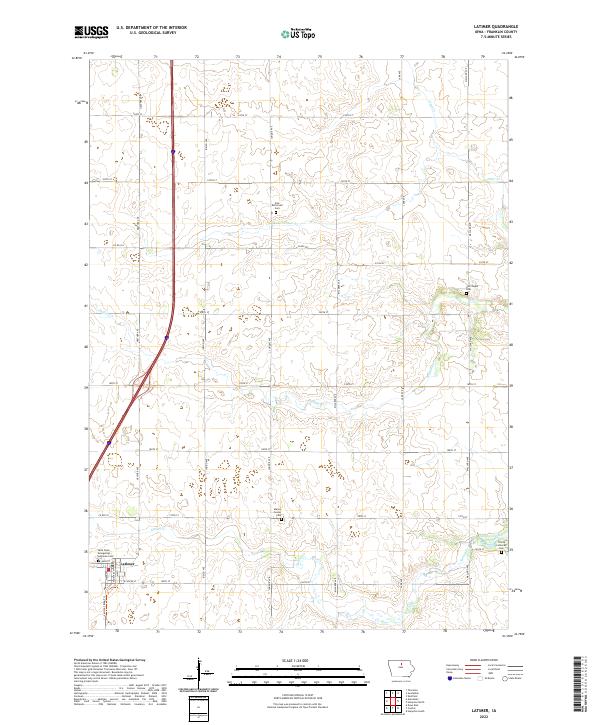
2022 Map of Latimer
USGS Topo · Published 2022About this map
Latimer serves as the primary hub of activity in this section of Franklin County, where a grid of rural roads connects well-established family farms and historic burial grounds. The township structure is clearly defined by the Public Land Survey System, with a landscape drained by the meandering paths of Buffalo Cr and Spring Creek. Genealogical value is high throughout the quadrangle, which documents several significant denominational sites, including the Saint Pauls Evangelical Lutheran Cem and the Zion Reformed Cem. Modern recreation appears alongside traditional land use, seen in the Latimer Bike Trl extending from the town center. The map also captures several smaller, dedicated burial sites such as the Old Chapin Cem and Marion Center Cem, providing a precise look at the community's ancestral landmarks and drainage patterns like Ditch Number 55.
Find a feature on this map
38 named features on this map. Tap any name to fly to it.
Don’t see what you’re looking for? This feature index may not catch every label — zoom into the map to look around manually.
Map Details
Editions of this 2022 Latimer Map
This is the sole edition of this map. No revisions or reprints were ever made.
Other maps of this area

1954 · Waterloo
USGS Topo · 1:250,000

1955 · Waterloo
USGS Topo · 1:250,000

1972 · Alexander
USGS Topo · 1:24,000

1972 · Thornton
USGS Topo · 1:24,000

1972 · Swaledale
USGS Topo · 1:24,000
1972 · Sheffield
USGS Topo · 1:24,000

1972 · Latimer
USGS Topo · 1:24,000

1972 · Hampton North
USGS Topo · 1:24,000

1979 · Dows East
USGS Topo · 1:24,000

1979 · Coulter
USGS Topo · 1:24,000