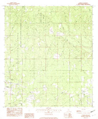
1982 Map of Latimer
USGS Topo · Published 1982About this map
The University of Mississippi Forest and the Red Creek State Wildlife Management Area dominate this southern Mississippi landscape, illustrating a region defined by managed timberlands and conservation boundaries. In the early 1980s, the settlement of Latimer serves as the primary hub, flanked by the De Soto National Forest. The map reveals a high concentration of community landmarks for genealogists, particularly small country churches and family burial grounds such as the Bethel Hill Cem and Seymour Cem.
Find a feature on this map
50 named features on this map. Tap any name to fly to it.
Don’t see what you’re looking for? This feature index may not catch every label — zoom into the map to look around manually.
Map Details
Editions of this 1982 Latimer Map
2 editions found
Other maps of this area

1941 · Vancleave
USGS Topo · 1:62,500

1943 · Pascagoula
USGS Topo · 1:62,500

1943 · Vancleave
USGS Topo · 1:62,500

1944 · Vancleave
USGS Topo · 1:62,500

1953 · Mobile
USGS Topo · 1:250,000

1954 · Vestry
USGS Topo · 1:62,500

1954 · Ocean Springs
USGS Topo · 1:24,000

1954 · Biloxi
USGS Topo · 1:24,000

1954 · Biloxi
USGS Topo · 1:62,500

1955 · Pascagoula
USGS Topo · 1:62,500