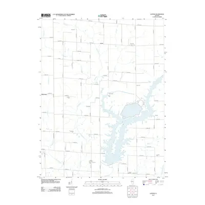
2012 Map of Latona
USGS Topo · Published 2012About this map
Newton Lake dominates the central and southern reaches of this landscape, its fingers reaching into the surrounding rural townships. The settlement of Latona sits near the northern boundary, while Winterrowd is situated to the west. This 2012 survey provides significant value for genealogists, as it documents an unusually high density of family-named burial grounds across the countryside. These include sites such as South Muddy Cem, Headyville Cem, and Kedron Cem, which reflect the long-standing agricultural communities of Jasper County. The drainage network is anchored by Big Muddy Cr, which meanders south toward the reservoir, joined by smaller tributaries like Sandy Cr and Crabapple Cr. The map preserves the grid-based rural road system, identifying numerous numbered avenues and streets that connect these scattered hamlets and historic cemeteries.
Find a feature on this map
67 named features on this map. Tap any name to fly to it.
Don’t see what you’re looking for? This feature index may not catch every label — zoom into the map to look around manually.
Map Details
Editions of this 2012 Latona Map
This is the sole edition of this map. No revisions or reprints were ever made.
Other maps of this area

1940 · Greenup
USGS Topo · 1:62,500

1941 · Newton
USGS Topo · 1:62,500

1943 · Greenup
USGS Topo · 1:62,500

1943 · Newton
USGS Topo · 1:62,500

1953 · Teutopolis
USGS Topo · 1:62,500

1953 · Sailor Springs
USGS Topo · 1:62,500

1958 · Decatur
USGS Topo · 1:250,000

1958 · Belleville
USGS Topo · 1:250,000

1961 · Decatur
USGS Topo · 1:250,000

1962 · Belleville
USGS Topo · 1:250,000