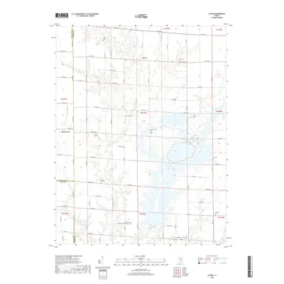
2018 Map of Latona
USGS Topo · Published 2018About this map
The agrarian landscape of southeastern Illinois is defined by the intersection of Jasper, Effingham, and Clay counties, where small unincorporated settlements like Latona and Winterrowd anchor a network of rural section roads. This 2018 survey reveals a terrain where traditional family farming footprints exist alongside significant modern water management. The southern portion of the sheet is dominated by the sprawling fingers of Newton Lake, a large reservoir created for industrial cooling that now dictates the local geography, while smaller bodies like Burgett Lake sit tucked among the drainages of Big Muddy Cr and Sandy Cr.
Find a feature on this map
77 named features on this map. Tap any name to fly to it.
Don’t see what you’re looking for? This feature index may not catch every label — zoom into the map to look around manually.
Map Details
Editions of this 2018 Latona Map
This is the sole edition of this map. No revisions or reprints were ever made.
Other maps of this area

1940 · Greenup
USGS Topo · 1:62,500

1941 · Newton
USGS Topo · 1:62,500

1943 · Greenup
USGS Topo · 1:62,500

1943 · Newton
USGS Topo · 1:62,500

1953 · Teutopolis
USGS Topo · 1:62,500

1953 · Sailor Springs
USGS Topo · 1:62,500

1958 · Decatur
USGS Topo · 1:250,000

1958 · Belleville
USGS Topo · 1:250,000

1961 · Decatur
USGS Topo · 1:250,000

1962 · Belleville
USGS Topo · 1:250,000