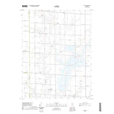
2021 Map of Latona
USGS Topo · Published 2021About this map
Latona and the surrounding farmland of Jasper County are defined by the winding course of Big Muddy Cr and its tributaries as they cut through the Illinois prairie. This landscape is marked by the sprawling reaches of Newton Lake in the southeast, a significant water feature that shapes the local geography alongside Burgett Lake. The settlement of Winterrowd sits on the western edge of the map, near the border with Effingham County. Numerous family and community burial grounds, such as Headyville Cem, Trexler Cem, and Foster Cem, are scattered across the rural sections, offering a look at the ancestral footprint of this agricultural region. The network of section-line roads, including Co HWY 5 and Co HWY 17, provides a framework for the rural homesteads that have occupied these plains for generations.
Find a feature on this map
64 named features on this map. Tap any name to fly to it.
Don’t see what you’re looking for? This feature index may not catch every label — zoom into the map to look around manually.
Map Details
Editions of this 2021 Latona Map
This is the sole edition of this map. No revisions or reprints were ever made.
Other maps of this area

1940 · Greenup
USGS Topo · 1:62,500

1941 · Newton
USGS Topo · 1:62,500

1943 · Greenup
USGS Topo · 1:62,500

1943 · Newton
USGS Topo · 1:62,500

1953 · Teutopolis
USGS Topo · 1:62,500

1953 · Sailor Springs
USGS Topo · 1:62,500

1958 · Decatur
USGS Topo · 1:250,000

1958 · Belleville
USGS Topo · 1:250,000

1961 · Decatur
USGS Topo · 1:250,000

1962 · Belleville
USGS Topo · 1:250,000