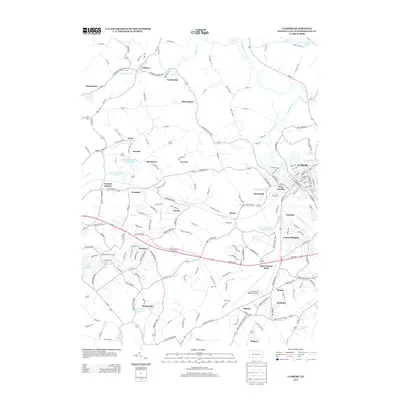
2013 Map of Latrobe
USGS Topo · Published 2013About this map
Latrobe serves as the primary urban hub on this Westmoreland County landscape, situated along the Loyalhanna Cr. The map details a transition from the dense street grids of West Latrobe and Lawson Heights to a series of surrounding industrial and residential hamlets like Saint Vincent Shaft, Hostetter, and Whitney. The presence of the Arnold Palmer Regional Airport and the Statlers Par 3 Golf Course highlights the modern aviation and recreational character of the region.
Find a feature on this map
187 named features on this map. Tap any name to fly to it.
Don’t see what you’re looking for? This feature index may not catch every label — zoom into the map to look around manually.
Map Details
Editions of this 2013 Latrobe Map
This is the sole edition of this map. No revisions or reprints were ever made.
Other maps of this area

1900 · Latrobe
USGS Topo · 1:62,500

1902 · Latrobe
USGS Topo · 1:62,500

1902 · Connellsville
USGS Topo · 1:62,500

1903 · Latrobe
USGS Topo · 1:62,500

1904 · Greensburg
USGS Topo · 1:62,500

1906 · Greensburg
USGS Topo · 1:62,500

1922 · Donegal
USGS Topo · 1:62,500

1931 · Connellsville
USGS Topo · 1:62,500

1935 · Donegal
USGS Topo · 1:62,500

1936 · Connellsville
USGS Topo · 1:62,500