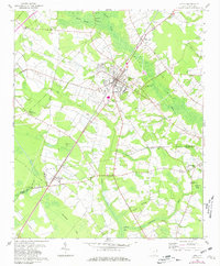
1960 Map of Latta
USGS Topo · Published 1980About this map
The town of Latta serves as the focal point of this 1960 survey, later updated in 1980, showcasing the agricultural and transport patterns of the Dillon Co-Marion Co border. The Seaboard Coast Line railroad anchors the local economy, cutting through the landscape and connecting the main settlement to Sellers in the southwest. A distinct network of rural institutions, including Sardis Ch, Bethel Hill Ch, and the Lattimer Sch, illustrates the community structure during this era.
Find a feature on this map
43 named features on this map. Tap any name to fly to it.
Don’t see what you’re looking for? This feature index may not catch every label — zoom into the map to look around manually.
Map Details
Editions of this 1960 Latta Map
2 editions found
Other maps of this area

1940 · Florence East
USGS Topo · 1:62,500

1943 · Gum Swamp
USGS Topo · 1:62,500

1945 · Florence East
USGS Topo · 1:62,500

1946 · Mullins
USGS Topo · 1:24,000

1947 · Marion
USGS Topo · 1:24,000

1947 · Mullins
USGS Topo · 1:24,000

1953 · Florence
USGS Topo · 1:250,000

1954 · Florence
USGS Topo · 1:250,000

1959 · Fork
USGS Topo · 1:24,000

1960 · Latta
USGS Topo · 1:24,000