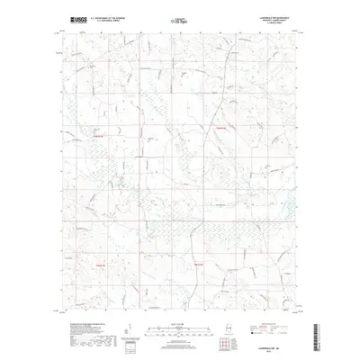
2018 Map of Lauderdale NW
USGS Topo · Published 2018About this map
Pawticfaw Creek and its numerous tributaries define the drainage patterns across this rural Mississippi landscape on the Kemper and Lauderdale county line. The terrain is marked by a network of local roads named for established families and community landmarks, such as Shiloh Church Rd and Eddie Payton Rd. Genealogists will find significant value in the distribution of local burial grounds, including New Hope Cem, Hampton Cem, and Rush Cem, which are tucked away from the main thoroughfares. The southern portion of the survey is dominated by the headwaters of the Blackwater Cr and its feeder, Mineral Springs Br. These watercourses, along with Bruton Pond, reflect the importance of natural water sources to the local agricultural and timber economy in this region.
Find a feature on this map
75 named features on this map. Tap any name to fly to it.
Don’t see what you’re looking for? This feature index may not catch every label — zoom into the map to look around manually.
Map Details
Editions of this 2018 Lauderdale NW Map
This is the sole edition of this map. No revisions or reprints were ever made.
Other maps of this area

1953 · Meridian
USGS Topo · 1:250,000

1957 · Meridian
USGS Topo · 1:250,000

1962 · Lynville
USGS Topo · 1:24,000

1962 · Daleville
USGS Topo · 1:24,000

1962 · Lauderdale
USGS Topo · 1:24,000

1962 · Lauderdale NW
USGS Topo · 1:24,000

1962 · Center Hill
USGS Topo · 1:24,000

1962 · Oak Grove
USGS Topo · 1:24,000

1962 · Moscow
USGS Topo · 1:24,000

1963 · De Kalb
USGS Topo · 1:24,000