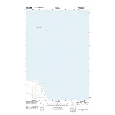
2011 Map of Laughing Fish Point OE E
USGS Topo · Published 2011About this map
Lake Superior dominates this nautical-focused map, showing the expansive waters off the coast of Alger County. The most prominent submerged feature is North Drisco Shoal, a landmark of navigational significance in the open water. Along the coastline, the development is minimal, characterized by a thin network of coastal access roads, most notably Shore Dr, which provides the primary terrestrial link to this stretch of the Michigan shoreline. The map focuses heavily on the aquatic expanse and the immediate coastal fringe, illustrating the sparse human footprint in this specific portion of the Upper Peninsula during the early twenty-first century.
Find a feature on this map
3 named features on this map. Tap any name to fly to it.
Don’t see what you’re looking for? This feature index may not catch every label — zoom into the map to look around manually.
Map Details
Editions of this 2011 Laughing Fish Point OE E Map
This is the sole edition of this map. No revisions or reprints were ever made.
Other maps of this area

1932 · Skandia NE
USGS Topo · 1:31,680

1958 · Au Train
USGS Topo · 1:62,500

1958 · Laughing Fish Point
USGS Topo · 1:62,500

1958 · Skandia
USGS Topo · 1:62,500

1958 · Marquette
USGS Topo · 1:250,000

1960 · Marquette
USGS Topo · 1:250,000

1961 · Marquette
USGS Topo · 1:250,000

1968 · Marquette
USGS Topo · 1:250,000
1983 · Gwinn
USGS Topo · 1:100,000

1983 · Munising
USGS Topo · 1:100,000