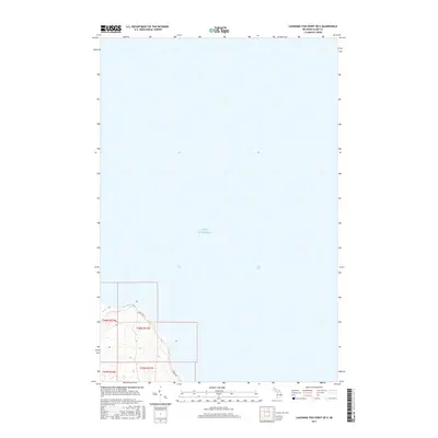
2017 Map of Laughing Fish Point OE E
USGS Topo · Published 2017About this map
Lake Superior dominates this northern survey, which focuses on the coastal reach of Alger County. The map details a thin strip of the Lake Superior shoreline where the terrestrial landscape meets the open water. A single established route, Shore Dr, follows the coastal contours, providing access to the various sections of Onota Township. The topography is defined by the steep elevation changes rising immediately from the water's edge, transitioning from the lake level up to the higher coastal bluffs. This 2017 edition documents the public land survey system grid, including the convergence of townships T48N R22W, T48N R21W, T47N R22W, and T47N R21W at this specific point on the Michigan coastline.
Find a feature on this map
6 named features on this map. Tap any name to fly to it.
Don’t see what you’re looking for? This feature index may not catch every label — zoom into the map to look around manually.
Map Details
Editions of this 2017 Laughing Fish Point OE E Map
This is the sole edition of this map. No revisions or reprints were ever made.
Other maps of this area

1932 · Skandia NE
USGS Topo · 1:31,680

1958 · Au Train
USGS Topo · 1:62,500

1958 · Laughing Fish Point
USGS Topo · 1:62,500

1958 · Skandia
USGS Topo · 1:62,500

1958 · Marquette
USGS Topo · 1:250,000

1960 · Marquette
USGS Topo · 1:250,000

1961 · Marquette
USGS Topo · 1:250,000

1968 · Marquette
USGS Topo · 1:250,000
1983 · Gwinn
USGS Topo · 1:100,000

1983 · Munising
USGS Topo · 1:100,000