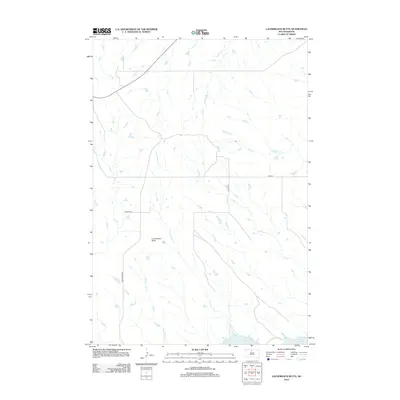
2012 Map of Laundreaux Butte
USGS Topo · Published 2012About this map
Laundreaux Butte rises above the drainage basins of north-central South Dakota, serving as a primary landmark in a landscape defined by an intricate network of seasonal and permanent watercourses. The drainage pattern is dominated by southward-flowing tributaries including Laundreaux Cr and Tom Hill Cr, which eventually meet the northern reaches of Lake Oahe. This 2012 survey illustrates the remote character of the Missouri River plateau just before it meets the massive reservoir, where high-country ridges separate the winding paths of Le Beau Cr and Deadman Cr. The map details a transition from the elevated butte country down to the riparian edge, connected by a sparse network of county routes and Whitehorse Rd that follow the natural contours of the undulating plains.
Find a feature on this map
11 named features on this map. Tap any name to fly to it.
Don’t see what you’re looking for? This feature index may not catch every label — zoom into the map to look around manually.
Map Details
Editions of this 2012 Laundreaux Butte Map
This is the sole edition of this map. No revisions or reprints were ever made.
Other maps of this area

1951 · Promise
USGS Topo · 1:24,000

1952 · Trail City SW
USGS Topo · 1:24,000

1953 · McIntosh
USGS Topo · 1:250,000

1956 · Wakpala SE
USGS Topo · 1:24,000

1956 · Wakpala SW
USGS Topo · 1:24,000

1958 · McIntosh
USGS Topo · 1:250,000

1967 · Mobridge
USGS Topo · 1:24,000

1968 · Moreau NW
USGS Topo · 1:24,000

1968 · Moreau
USGS Topo · 1:24,000

1975 · Laundreaux Butte
USGS Topo · 1:24,000