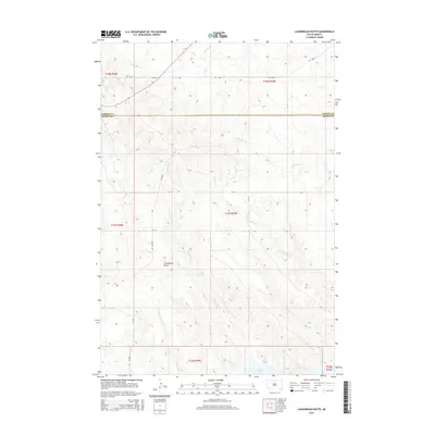
2015 Map of Laundreaux Butte
USGS Topo · Published 2015About this map
Laundreaux Butte rises as a prominent landmark in this stretch of the northern Missouri River valley along the border of Corson and Dewey counties. The landscape is defined by the complex drainage systems of Laundreaux Cr, Le Beau Cr, and Deadman Cr, which carve through the high plains toward the shores of Lake Oahe. This modern survey illustrates the enduring nature of the Public Land Survey System grid, which dictates the rural road network, including routes like CR-1806 and Co 3304. Named features such as Tom Hill Cr and Claymore Cr reflect the area's deep ties to local families and historical ranching, providing essential reference points in a region where the elevation and water patterns shaped the placement of early townships.
Find a feature on this map
20 named features on this map. Tap any name to fly to it.
Don’t see what you’re looking for? This feature index may not catch every label — zoom into the map to look around manually.
Map Details
Editions of this 2015 Laundreaux Butte Map
This is the sole edition of this map. No revisions or reprints were ever made.
Other maps of this area

1951 · Promise
USGS Topo · 1:24,000

1952 · Trail City SW
USGS Topo · 1:24,000

1953 · McIntosh
USGS Topo · 1:250,000

1956 · Wakpala SE
USGS Topo · 1:24,000

1956 · Wakpala SW
USGS Topo · 1:24,000

1958 · McIntosh
USGS Topo · 1:250,000

1967 · Mobridge
USGS Topo · 1:24,000

1968 · Moreau NW
USGS Topo · 1:24,000

1968 · Moreau
USGS Topo · 1:24,000

1975 · Laundreaux Butte
USGS Topo · 1:24,000