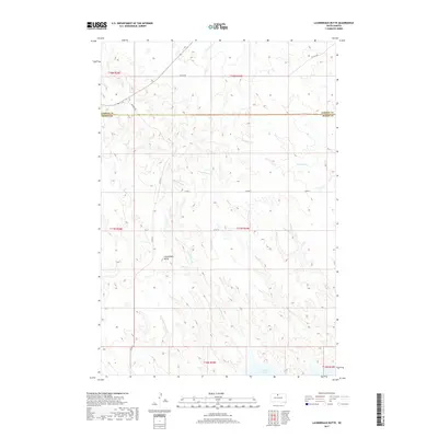
2017 Map of Laundreaux Butte
USGS Topo · Published 2017About this map
Laundreaux Butte rises above the rolling grasslands of the Standing Rock and Cheyenne River reservation borderlands, overlooking a landscape defined by seasonal watercourses and the northern reaches of Lake Oahe. This 2017 survey shows the transition between Corson and Dewey counties, where the drainage patterns of Laundreaux Cr, Le Beau Cr, and Deadman Cr have shaped the prairie for generations. The road network is sparse, primarily composed of rural routes like Promise Rd and several county roads, reflecting the vast, open character of this ranching country. By mapping the exact contours of the drainages, including Claymore Cr and Tom Hill Cr, the document provides a precise look at the hydrology of the Missouri River plateau in the modern era.
Find a feature on this map
20 named features on this map. Tap any name to fly to it.
Don’t see what you’re looking for? This feature index may not catch every label — zoom into the map to look around manually.
Map Details
Editions of this 2017 Laundreaux Butte Map
This is the sole edition of this map. No revisions or reprints were ever made.
Other maps of this area

1951 · Promise
USGS Topo · 1:24,000

1952 · Trail City SW
USGS Topo · 1:24,000

1953 · McIntosh
USGS Topo · 1:250,000

1956 · Wakpala SE
USGS Topo · 1:24,000

1956 · Wakpala SW
USGS Topo · 1:24,000

1958 · McIntosh
USGS Topo · 1:250,000

1967 · Mobridge
USGS Topo · 1:24,000

1968 · Moreau NW
USGS Topo · 1:24,000

1968 · Moreau
USGS Topo · 1:24,000

1975 · Laundreaux Butte
USGS Topo · 1:24,000