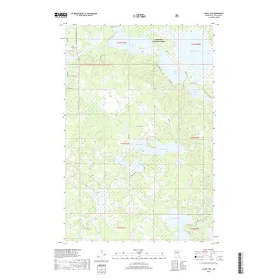
2019 Map of Laura Lake
USGS Topo · Published 2019About this map
Chippewa National Forest dominates this section of Cass County, where a dense network of glacial lakes and wetlands characterizes the northern Minnesota landscape. Water is the defining feature, ranging from the large basins of Upper Trelipe Lake and Lower Trelipe Lake to smaller, distinctively shaped bodies like Mitten Lake and Island Lake. The map reveals a land utilized for both conservation and recreation, evidenced by the presence of the Lost Girl Gia Snowmobile Trail and seasonal access roads like Thunder Lake Lodge Dr NE.
Find a feature on this map
52 named features on this map. Tap any name to fly to it.
Don’t see what you’re looking for? This feature index may not catch every label — zoom into the map to look around manually.
Map Details
Editions of this 2019 Laura Lake Map
This is the sole edition of this map. No revisions or reprints were ever made.
Other maps of this area

1953 · Duluth
USGS Topo · 1:250,000

1953 · Brainerd
USGS Topo · 1:250,000

1954 · Bemidji
USGS Topo · 1:250,000

1954 · Hibbing
USGS Topo · 1:250,000

1957 · Brainerd
USGS Topo · 1:250,000

1957 · Bemidji
USGS Topo · 1:250,000

1957 · Hibbing
USGS Topo · 1:250,000

1958 · Bemidji
USGS Topo · 1:250,000

1958 · Hibbing
USGS Topo · 1:250,000

1958 · Brainerd
USGS Topo · 1:250,000