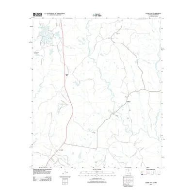
2012 Map of Laurel Hill
USGS Topo · Published 2012About this map
Wakefield and the surrounding West Feliciana Parish landscape are defined by the intricate network of the W Fork Thompson Cr and its numerous tributaries. This 2012 survey illustrates a region where local geography is tied to family legacies, evidenced by the high density of private burial grounds such as McCausland Cem, Minor Cem, and Richardson Cem. These sites, scattered across the terrain from Cornor to Alice, suggest a deep-rooted genealogical history of the area's rural settlements.
Find a feature on this map
70 named features on this map. Tap any name to fly to it.
Don’t see what you’re looking for? This feature index may not catch every label — zoom into the map to look around manually.
Map Details
Editions of this 2012 Laurel Hill Map
This is the sole edition of this map. No revisions or reprints were ever made.
Other maps of this area

1906 · Bayou Sara
USGS Topo · 1:125,000

1936 · Woodville
USGS Topo · 1:62,500

1939 · St. Francisville
USGS Topo · 1:62,500

1941 · Lost Creek
USGS Topo · 1:31,680

1945 · Jackson
USGS Topo · 1:31,680

1945 · Lost Creek
USGS Topo · 1:31,680

1953 · Natchez
USGS Topo · 1:250,000

1954 · Elm Park
USGS Topo · 1:24,000
1954 · Jackson
USGS Topo · 1:24,000

1954 · Baton Rouge
USGS Topo · 1:250,000