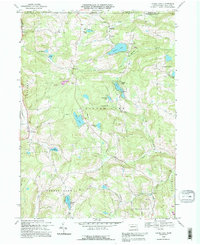
1992 Map of Laurel Lake
USGS Topo · Published 1995About this map
Glacial lakes and small rural settlements dot the rolling landscape of Susquehanna County along the New York border. This terrain is defined by its water, from the central expanse of Silver Lake and the recreational waters of Quaker Lake to smaller basins like Cranberry Lake and Lake Timberline. The survey highlights a quiet upland economy where traditional landmarks like Fisk Mill and several Quarry sites are interspersed with local social centers including St Joseph and Brackney.
Find a feature on this map
37 named features on this map. Tap any name to fly to it.
Don’t see what you’re looking for? This feature index may not catch every label — zoom into the map to look around manually.
Map Details
Editions of this 1992 Laurel Lake Map
This is the sole edition of this map. No revisions or reprints were ever made.
Other maps of this area

1901 · Apalachin
USGS Topo · 1:62,500

1904 · Binghamton
USGS Topo · 1:62,500

1904 · Apalachin
USGS Topo · 1:62,500

1906 · Catatonk
USGS Topo · 1:125,000

1935 · Binghamton West
USGS Topo · 1:24,000

1937 · Binghamton East
USGS Topo · 1:24,000

1942 · Binghamton West
USGS Topo · 1:31,680

1942 · Binghamton East
USGS Topo · 1:31,680

1943 · Montrose
USGS Topo · 1:62,500

1943 · Le Raysville
USGS Topo · 1:62,500