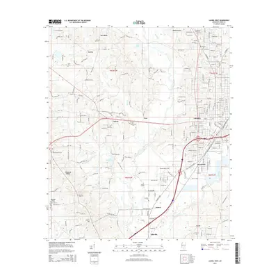
2015 Map of Laurel West
USGS Topo · Published 2015About this map
The city of Laurel and its western outskirts appear as a complex network of residential grids and winding rural routes in this 2015 study of Jones County. The landscape is defined by the drainage of Tallahoma Creek and its many tributaries, including Joes Br, Mill Cr, and Boler Br, which carve through the undulating terrain. A distinct cluster of educational and religious institutions anchors the northern areas, notably Southeastern Baptist Coll and Shady Grove. To the south, the industrial and aviation footprint of Hesler-Noble Field sits between the growing residential tracts of Queensburg and Pendorff. Family history and local heritage are preserved in numerous burial grounds across the quadrangle, from the Laurel Cem and Windham Cem in the urban center to the Spring Hill Cem and Mount Zion Cem in the outlying woodlots and hills.
Find a feature on this map
183 named features on this map. Tap any name to fly to it.
Don’t see what you’re looking for? This feature index may not catch every label — zoom into the map to look around manually.
Map Details
Editions of this 2015 Laurel West Map
This is the sole edition of this map. No revisions or reprints were ever made.
Other maps of this area

1953 · Hattiesburg
USGS Topo · 1:250,000

1958 · Hattiesburg
USGS Topo · 1:250,000

1964 · Moss
USGS Topo · 1:24,000

1964 · Sandersville
USGS Topo · 1:24,000

1964 · Laurel East
USGS Topo · 1:24,000

1964 · Laurel West
USGS Topo · 1:24,000

1964 · Ellisville
USGS Topo · 1:24,000

1964 · Lanham
USGS Topo · 1:24,000

1965 · Hebron
USGS Topo · 1:24,000

1965 · Moselle
USGS Topo · 1:24,000