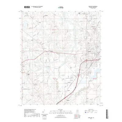
2018 Map of Laurel West
USGS Topo · Published 2018About this map
Tallahoma Creek and its many tributaries, including Boler Br and Box Ankle Br, carve through the rolling landscape west of Laurel in this 2018 survey. The region is defined by a network of rural settlements like Shady Grove, Calhoun, and Pleasant Ridge, each centered around historic congregational markers such as Calhoun Cem and the Our Home Universalist Cem. The presence of Southeastern Baptist College in the northeast and Hesler-Noble Field near Pendorff highlights the area's role as a regional hub for education and transportation in Jones County. Local genealogy is deeply rooted here, evidenced by numerous family and community burial grounds, from the Spring Hill Cem near Springhill to the Pilgrims Rest Cem near Walters. The landscape transitions from the developed streets of western Laurel to the prominent rise of Buffalo Hill in the south, reflecting a mix of residential growth and timber-rich bottomlands.
Find a feature on this map
253 named features on this map. Tap any name to fly to it.
Don’t see what you’re looking for? This feature index may not catch every label — zoom into the map to look around manually.
Map Details
Editions of this 2018 Laurel West Map
This is the sole edition of this map. No revisions or reprints were ever made.
Other maps of this area

1953 · Hattiesburg
USGS Topo · 1:250,000

1958 · Hattiesburg
USGS Topo · 1:250,000

1964 · Moss
USGS Topo · 1:24,000

1964 · Sandersville
USGS Topo · 1:24,000

1964 · Laurel East
USGS Topo · 1:24,000

1964 · Laurel West
USGS Topo · 1:24,000

1964 · Ellisville
USGS Topo · 1:24,000

1964 · Lanham
USGS Topo · 1:24,000

1965 · Hebron
USGS Topo · 1:24,000

1965 · Moselle
USGS Topo · 1:24,000