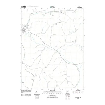
2010 Map of Laurelville
USGS Topo · Published 2010About this map
Laurelville and Adelphi anchor the western edge of this terrain, where the foothills meet the drainages of Salt Creek and Brimstone Creek. The landscape is heavily marked by small rural cemeteries such as Old Methodist Cemetery, Bellevue Cemetery, and Friend Cemetery, reflecting generations of settlement across the ridges and hollows. Roads like Thompson Ridge Rd and Pole Ridge Rd follow the high ground, connecting small communities like South Perry and the locality of Apple. To the south, Pine Lake and its corresponding Pine Lake Dam provide a distinct water feature amidst a complex network of runs and branches, including California Branch and Little Pine Creek. The distribution of these family-named landmarks and small burial grounds suggests a long-established rural population density that has persisted through the early 21st century.
Find a feature on this map
70 named features on this map. Tap any name to fly to it.
Don’t see what you’re looking for? This feature index may not catch every label — zoom into the map to look around manually.
Map Details
Editions of this 2010 Laurelville Map
This is the sole edition of this map. No revisions or reprints were ever made.
Other maps of this area

1906 · Chillicothe
USGS Topo · 1:62,500

1907 · Lancaster
USGS Topo · 1:62,500

1908 · Chillicothe
USGS Topo · 1:62,500

1909 · Lancaster
USGS Topo · 1:62,500

1910 · Laurelville
USGS Topo · 1:62,500

1912 · Laurelville
USGS Topo · 1:62,500

1914 · Circleville
USGS Topo · 1:62,500

1943 · Circleville
USGS Topo · 1:62,500

1944 · Laurelville
USGS Topo · 1:62,500

1947 · Columbus
USGS Topo · 1:250,000