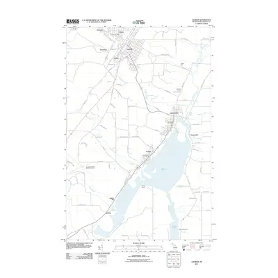
2011 Map of Laurium
USGS Topo · Published 2011About this map
The industrial legacy of the Keweenaw Peninsula is evident across this landscape, where the Quincy Mill stands near the shoreline of Torch Lake. The settlement of Mason and the village of Hubbell trace the western edge of the water, connected by the former pathways of the mining industry to upland communities like Laurium, Osceola, and Calumet. The concentration of population in the northwest corner around Swedetown and Tamarack contrasts with the more rural eastern reaches near the Trap Rock River. Local genealogy is well-supported by the presence of several significant burial grounds, including Hecla Cemetery, Maple Hill Cemetery, and Calvary Cemetery. The map also captures natural landmarks such as Hungarian Falls and Houghton Falls, alongside the infrastructure of the Houghton County Memorial Airport, illustrating the evolution from a resource-driven economy to a modern regional hub.
Find a feature on this map
91 named features on this map. Tap any name to fly to it.
Don’t see what you’re looking for? This feature index may not catch every label — zoom into the map to look around manually.
Map Details
Editions of this 2011 Laurium Map
This is the sole edition of this map. No revisions or reprints were ever made.
Other maps of this area

1915 · Houghton
USGS Topo · 1:62,500

1941 · Ahmeek
USGS Topo · 1:31,680

1941 · Mohawk
USGS Topo · 1:31,680

1946 · Hancock
USGS Topo · 1:24,000

1946 · Chassell
USGS Topo · 1:24,000

1946 · Mohawk
USGS Topo · 1:24,000

1946 · Muggun Creek
USGS Topo · 1:24,000

1946 · Ahmeek
USGS Topo · 1:24,000

1946 · Laurium
USGS Topo · 1:24,000

1947 · Ahmeek
USGS Topo · 1:24,000