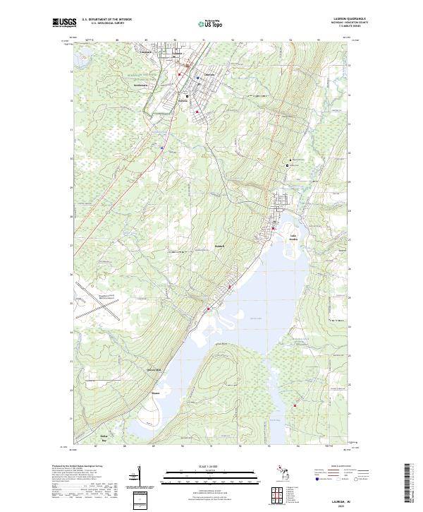
2023 Map of Laurium
USGS Topo · Published 2023About this map
Keweenaw National Historical Park anchors the northern portion of this map, encompassing the historic copper mining settlements of Calumet and Laurium. The landscape reflects the region's deep industrial heritage, where the residential grids of Tamarack, Swedetown, and Osceola are concentrated near the former mine sites and the Hecla Cem. To the southeast, the terrain drops toward the industrial shoreline of Torch Lake, where the milling legacy of the Copper Country is evidenced by the locations of Quincy Mill, Mason, and the docks at Hubbell. The map captures the transition from heavy industry to modern local infrastructure, including the Houghton County Memorial Airport near Dollar Bay. Local genealogists will find value in the detailed street-level layout of Lake Linden and the positioning of historic cemeteries such as Maple Hill Cem and Calvary Cem above the Trap Rock River.
Find a feature on this map
111 named features on this map. Tap any name to fly to it.
Don’t see what you’re looking for? This feature index may not catch every label — zoom into the map to look around manually.
Map Details
Editions of this 2023 Laurium Map
This is the sole edition of this map. No revisions or reprints were ever made.
Other maps of this area

1915 · Houghton
USGS Topo · 1:62,500

1941 · Ahmeek
USGS Topo · 1:31,680

1941 · Mohawk
USGS Topo · 1:31,680

1946 · Hancock
USGS Topo · 1:24,000

1946 · Chassell
USGS Topo · 1:24,000

1946 · Mohawk
USGS Topo · 1:24,000

1946 · Muggun Creek
USGS Topo · 1:24,000

1946 · Ahmeek
USGS Topo · 1:24,000

1946 · Laurium
USGS Topo · 1:24,000

1947 · Ahmeek
USGS Topo · 1:24,000