
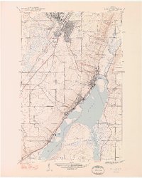
1948 Map of Laurium
USGS Topo · Published 1948About this map
Calumet and Laurium anchor the northern landscape of this post-war Copper Country survey, revealing a region defined by its industrial heritage and residential growth. The intricate rail networks of the Copper Range Railroad, Mineral Range Railroad, and the Hecla and Torch Lake Railroad converge on the shoreline of Torch Lake, where the Quincy Mill stands as a landmark of the local mining economy. Smaller settlements like Osceola, Hubbell, and Lake Linden are clustered along the slopes and waterfronts, connected by a web of local roads and waterways like Hammell Creek. This 1948 edition captures the area just after the peak of its mining era, documenting civic staples like the Osceola Sch, Traprock Sch, and the Maple Hill Cem and Calvary Cem north of Houghton Falls.
Find a feature on this map
30 named features on this map. Tap any name to fly to it.
Don’t see what you’re looking for? This feature index may not catch every label — zoom into the map to look around manually.
Map Details
Editions of this 1948 Laurium Map
2 editions found
Other maps of this area

1915 · Houghton
USGS Topo · 1:62,500

1941 · Ahmeek
USGS Topo · 1:31,680

1941 · Mohawk
USGS Topo · 1:31,680

1946 · Hancock
USGS Topo · 1:24,000

1946 · Chassell
USGS Topo · 1:24,000

1946 · Mohawk
USGS Topo · 1:24,000

1946 · Muggun Creek
USGS Topo · 1:24,000

1946 · Ahmeek
USGS Topo · 1:24,000

1946 · Laurium
USGS Topo · 1:24,000

1947 · Ahmeek
USGS Topo · 1:24,000