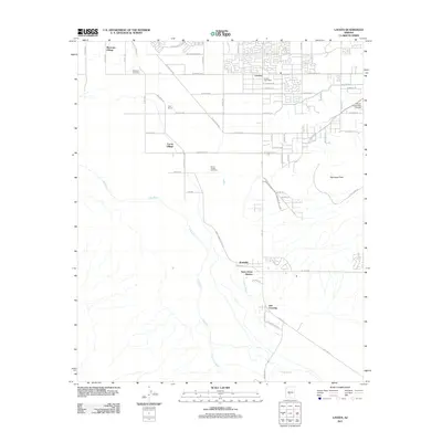
2011 Map of Laveen
USGS Topo · Published 2011About this map
Maricopa Village and the surrounding agricultural landscapes define this portion of the Salt River Valley southwest of Phoenix. The map illustrates a transition from residential developments in Laveen to the tribal lands of the Gila River Indian Community. The influence of water management on the arid terrain is evident through the winding path of the Gila River and the engineered routes of the Hoover Ditch.
Find a feature on this map
63 named features on this map. Tap any name to fly to it.
Don’t see what you’re looking for? This feature index may not catch every label — zoom into the map to look around manually.
Map Details
Editions of this 2011 Laveen Map
This is the sole edition of this map. No revisions or reprints were ever made.
Other maps of this area

1912 · Phoenix
USGS Topo · 1:62,500

1913 · Maricopa
USGS Topo · 1:62,500

1914 · Phoenix
USGS Topo · 1:62,500

1915 · Maricopa
USGS Topo · 1:62,500

1946 · Avondale
USGS Topo · 1:62,500

1948 · Cashion
USGS Topo · 1:62,500

1951 · Mobile
USGS Topo · 1:62,500

1952 · Lone Butte
USGS Topo · 1:24,000

1952 · Laveen
USGS Topo · 1:24,000
1952 · Pima Butte
USGS Topo · 1:24,000