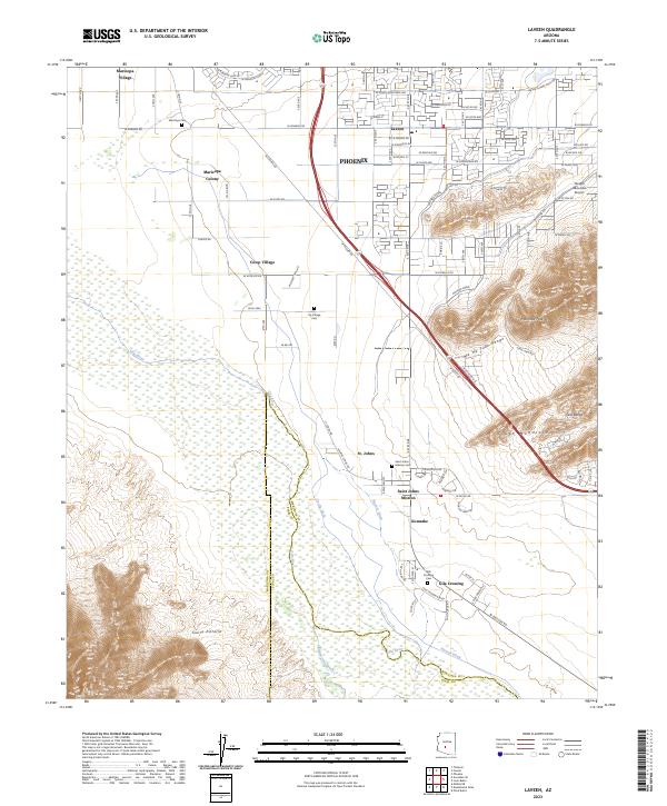
2023 Map of Laveen
USGS Topo · Published 2023About this map
Settlements along the Gila River south of Phoenix reveal a landscape defined by traditional irrigation and cultural boundaries. The southern portion of the map is dominated by the Sierra Estrella and the South Mountains, with water management systems like the Hoover Ditch and Co-Op Ditch supporting agricultural life in communities such as Maricopa Colony and Co-op Village. This area shows the continued importance of historic mission sites, including the Saint Johns Mission and its associated Saint Johns Mission Cem.
Find a feature on this map
73 named features on this map. Tap any name to fly to it.
Don’t see what you’re looking for? This feature index may not catch every label — zoom into the map to look around manually.
Map Details
Editions of this 2023 Laveen Map
This is the sole edition of this map. No revisions or reprints were ever made.
Other maps of this area

1912 · Phoenix
USGS Topo · 1:62,500

1913 · Maricopa
USGS Topo · 1:62,500

1914 · Phoenix
USGS Topo · 1:62,500

1915 · Maricopa
USGS Topo · 1:62,500

1946 · Avondale
USGS Topo · 1:62,500

1948 · Cashion
USGS Topo · 1:62,500

1951 · Mobile
USGS Topo · 1:62,500

1952 · Lone Butte
USGS Topo · 1:24,000

1952 · Laveen
USGS Topo · 1:24,000
1952 · Pima Butte
USGS Topo · 1:24,000