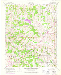
1956 Map of Laverty
USGS Topo · Published 1976About this map
St Louis San Francisco railroad tracks cross the northern landscape of this Grady County survey, connecting the rural communities of Laverty and Norge. This mid-century map captures a transition in Oklahoma’s energy and recreational landscape, documenting the Lake Louis Burtschi State Game Reservation and the extensive North Cement Gas Field. The industrial character of the region is evident in the network of pipelines and clusters of oil wells that punctuate the terrain between East Bills Creek and McCarty Creek.
Find a feature on this map
34 named features on this map. Tap any name to fly to it.
Don’t see what you’re looking for? This feature index may not catch every label — zoom into the map to look around manually.
Map Details
Editions of this 1956 Laverty Map
2 editions found
Other maps of this area

1902 · Rush Springs
USGS Topo · 1:125,000

1904 · Chickasha
USGS Topo · 1:125,000

1945 · Anadarko
USGS Topo · 1:62,500

1949 · Cement
USGS Topo · 1:62,500

1949 · Rush Springs
USGS Topo · 1:62,500

1950 · Rush Springs
USGS Topo · 1:62,500

1954 · Oklahoma City
USGS Topo · 1:250,000

1955 · Lawton
USGS Topo · 1:250,000

1955 · Clinton
USGS Topo · 1:250,000

1956 · Laverty
USGS Topo · 1:24,000