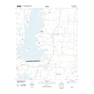
2010 Map of Lavon
USGS Topo · Published 2010About this map
Lavon Lake dominates the central landscape of this North Texas region, where the massive Lavon Dam impounds the waters of the East Fork Trinity River. The surrounding terrain is a mixture of established rural settlements like Copeville and Lavon, alongside numerous residential developments that line the jagged eastern and western shores. These lakeside communities, including Yucote Acres, Pebble Beach Sunset Acres, and Little Ridge, illustrate the mid-to-late 20th-century transition of the area from purely agricultural land to a recreational and residential hub for the Dallas metroplex.
Find a feature on this map
76 named features on this map. Tap any name to fly to it.
Don’t see what you’re looking for? This feature index may not catch every label — zoom into the map to look around manually.
Map Details
Editions of this 2010 Lavon Map
This is the sole edition of this map. No revisions or reprints were ever made.
Other maps of this area

1891 · Dallas
USGS Topo · 1:125,000

1893 · Dallas
USGS Topo · 1:125,000

1912 · Rockwall
USGS Topo · 1:31,680

1919 · Royse City
USGS Topo · 1:62,500

1924 · Farmersville 3-c
USGS Topo · 1:48,000

1924 · Mc Kinney 4-d
USGS Topo · 1:48,000

1929 · McKinney
USGS Topo · 1:62,500

1930 · Farmersville
USGS Topo · 1:62,500

1954 · Dallas
USGS Topo · 1:250,000

1954 · Sherman
USGS Topo · 1:250,000