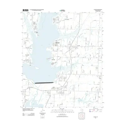
2013 Map of Lavon
USGS Topo · Published 2013About this map
Lavon Lake dominates this Collin County landscape, its expansive waters and branching arms creating a complex shoreline that defines the surrounding residential and agricultural patterns. To the east and south, the settlements of Lavon and Nevada maintain their identity alongside several distinct lakeside communities like Pebble Beach Sunset Acres and Yucote Acres. The geography is intricately carved by numerous tributaries, including Elm Cr, Bear Cr, and the E Fork Trinity River, which feed into the primary reservoir system.
Find a feature on this map
112 named features on this map. Tap any name to fly to it.
Don’t see what you’re looking for? This feature index may not catch every label — zoom into the map to look around manually.
Map Details
Editions of this 2013 Lavon Map
This is the sole edition of this map. No revisions or reprints were ever made.
Other maps of this area

1891 · Dallas
USGS Topo · 1:125,000

1893 · Dallas
USGS Topo · 1:125,000

1912 · Rockwall
USGS Topo · 1:31,680

1919 · Royse City
USGS Topo · 1:62,500

1924 · Farmersville 3-c
USGS Topo · 1:48,000

1924 · Mc Kinney 4-d
USGS Topo · 1:48,000

1929 · McKinney
USGS Topo · 1:62,500

1930 · Farmersville
USGS Topo · 1:62,500

1954 · Dallas
USGS Topo · 1:250,000

1954 · Sherman
USGS Topo · 1:250,000