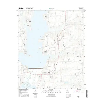
2016 Map of Lavon
USGS Topo · Published 2016About this map
Lavon Lake dominates the western portion of this landscape, its indented shoreline giving rise to numerous residential developments such as Lavon Beach Estates, Lavon Shores Estates, and Deep Water Point Estates. The topography reflects a transition from the water's edge to the productive plains of eastern Collin County, where the historic settlements of Copeville, Lavon, and Nevada are situated. These communities are linked by a network of farm-to-market and county roads that navigate between various tributaries like Bear Creek and Elm Cr.
Find a feature on this map
146 named features on this map. Tap any name to fly to it.
Don’t see what you’re looking for? This feature index may not catch every label — zoom into the map to look around manually.
Map Details
Editions of this 2016 Lavon Map
This is the sole edition of this map. No revisions or reprints were ever made.
Other maps of this area

1891 · Dallas
USGS Topo · 1:125,000

1893 · Dallas
USGS Topo · 1:125,000

1912 · Rockwall
USGS Topo · 1:31,680

1919 · Royse City
USGS Topo · 1:62,500

1924 · Farmersville 3-c
USGS Topo · 1:48,000

1924 · Mc Kinney 4-d
USGS Topo · 1:48,000

1929 · McKinney
USGS Topo · 1:62,500

1930 · Farmersville
USGS Topo · 1:62,500

1954 · Dallas
USGS Topo · 1:250,000

1954 · Sherman
USGS Topo · 1:250,000