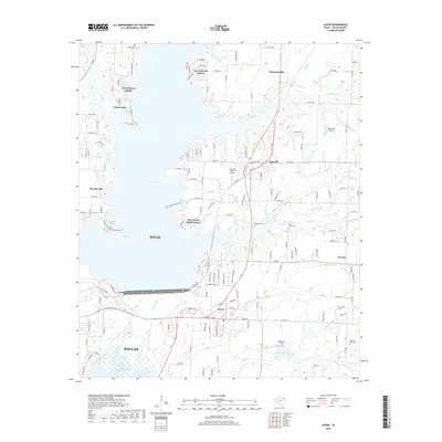
2019 Map of Lavon
USGS Topo · Published 2019About this map
Lavon Lake dominates this northeast Texas landscape, its expansive shoreline dotted with residential developments like Lavon Shores Estates, Yucote Acres, and Deep Water Point Estates. The map illustrates the contemporary intersection of recreational water access and suburban growth in Collin and Dallas counties. Established towns such as Farmersville, Copeville, and Nevada border the reservoir, while the southern reaches show the East Fork Trinity River winding toward Corder Lake and Moores Lake.
Find a feature on this map
152 named features on this map. Tap any name to fly to it.
Don’t see what you’re looking for? This feature index may not catch every label — zoom into the map to look around manually.
Map Details
Editions of this 2019 Lavon Map
This is the sole edition of this map. No revisions or reprints were ever made.
Other maps of this area

1891 · Dallas
USGS Topo · 1:125,000

1893 · Dallas
USGS Topo · 1:125,000

1912 · Rockwall
USGS Topo · 1:31,680

1919 · Royse City
USGS Topo · 1:62,500

1924 · Farmersville 3-c
USGS Topo · 1:48,000

1924 · Mc Kinney 4-d
USGS Topo · 1:48,000

1929 · McKinney
USGS Topo · 1:62,500

1930 · Farmersville
USGS Topo · 1:62,500

1954 · Dallas
USGS Topo · 1:250,000

1954 · Sherman
USGS Topo · 1:250,000