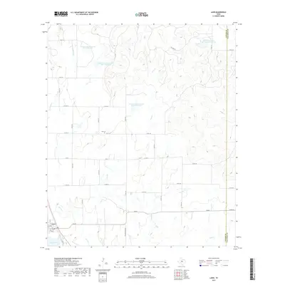
2019 Map of Lawn
USGS Topo · Published 2019About this map
Lawn sits at the southwestern edge of this landscape, where the local road network converges near the banks of Jim Ned Cr. The area is defined by a sophisticated system of water management, evidenced by several large reservoirs including Soil Conservation Service Site 17 Reservoir and Soil Conservation Service Site 15 Reservoir, which capture runoff from the various creek branches that dissect the terrain. These man-made features highlight the region's adaptation to the semi-arid conditions of the Texas plains.
Find a feature on this map
49 named features on this map. Tap any name to fly to it.
Don’t see what you’re looking for? This feature index may not catch every label — zoom into the map to look around manually.
Map Details
Editions of this 2019 Lawn Map
This is the sole edition of this map. No revisions or reprints were ever made.
Other maps of this area

1890 · Abilene
USGS Topo · 1:125,000

1892 · Abilene
USGS Topo · 1:125,000

1954 · Abilene
USGS Topo · 1:250,000

1957 · Kirby Lake
USGS Topo · 1:62,500

1957 · Buffalo Gap
USGS Topo · 1:62,500

1958 · Abilene
USGS Topo · 1:250,000

1967 · Tuscola
USGS Topo · 1:24,000
1967 · McEwen Draw
USGS Topo · 1:24,000
1967 · Lawn
USGS Topo · 1:24,000
1967 · Oplin
USGS Topo · 1:24,000