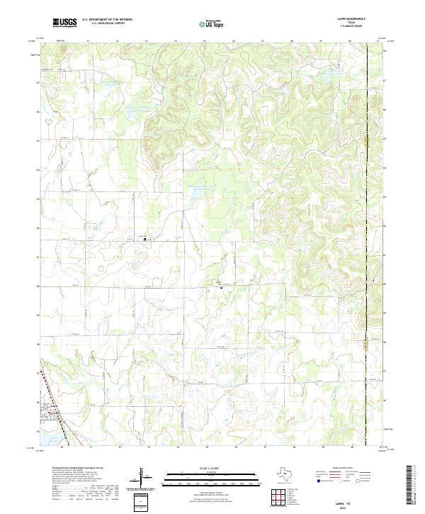
2022 Map of Lawn
USGS Topo · Published 2022About this map
The town of Lawn occupies the southwestern corner of this survey, established where the Santa Fe Railway once influenced local development near the convergence of Jim Ned Cr and Red Bank Cr. This modern topographic study reveals a landscape heavily managed for water and oil, defined by the numerous water retention structures like Soil Conservation Service Site 17 Reservoir and Soil Conservation Service Site 16 Reservoir that dot the drainage basins of Gray Br and Twomile Cr. For genealogists, the map preserves the locations of three distinct burial grounds: Snodgrass Cem in the northwest, Cope Cem central to the quadrangle, and Rogers Cem near FM 614. The presence of Oil Field Rd in the north suggests the continued economic importance of petroleum extraction in this section of the West Texas plains near the Taylor and Callahan county line.
Find a feature on this map
51 named features on this map. Tap any name to fly to it.
Don’t see what you’re looking for? This feature index may not catch every label — zoom into the map to look around manually.
Map Details
Editions of this 2022 Lawn Map
This is the sole edition of this map. No revisions or reprints were ever made.
Other maps of this area

1890 · Abilene
USGS Topo · 1:125,000

1892 · Abilene
USGS Topo · 1:125,000

1954 · Abilene
USGS Topo · 1:250,000

1957 · Kirby Lake
USGS Topo · 1:62,500

1957 · Buffalo Gap
USGS Topo · 1:62,500

1958 · Abilene
USGS Topo · 1:250,000

1967 · Tuscola
USGS Topo · 1:24,000
1967 · McEwen Draw
USGS Topo · 1:24,000
1967 · Lawn
USGS Topo · 1:24,000
1967 · Oplin
USGS Topo · 1:24,000