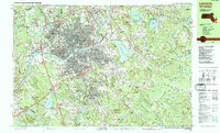
1987 Map of Lawrence
USGS Topo · Published 1987About this map
The Merrimack River bends through the heart of this late-twentieth-century industrial and academic landscape, dividing Lawrence and South Lawrence while anchoring a dense network of neighborhoods like Shawsheen Village and Ballardvale. This period shows the region's transition into a modern transportation hub, with Interstate 495 and Interstate 93 intersecting the older routes established by the Boston and Maine Railroad. High-relief drumlins and hills, including Holt Hill and Boston Hill, define the terrain south of the river, while the expansive Harold Parker State Forest and Boxford State Forest preserve large tracts of woodland. Prominent local institutions such as Phillips Academy in Andover and Merrimack College in North Andover are clearly delineated alongside numerous burial grounds like Bellevue Cemetery and St Marys Cem.
Find a feature on this map
99 named features on this map. Tap any name to fly to it.
Don’t see what you’re looking for? This feature index may not catch every label — zoom into the map to look around manually.
Map Details
Editions of this 1987 Lawrence Map
This is the sole edition of this map. No revisions or reprints were ever made.
Other maps of this area

1886 · Lawrence
USGS Topo · 1:62,500

1886 · Lowell
USGS Topo · 1:62,500

1888 · Newburyport
USGS Topo · 1:62,500

1888 · Haverhill
USGS Topo · 1:62,500

1888 · Lawrence
USGS Topo · 1:62,500

1888 · Salem
USGS Topo · 1:62,500

1890 · Haverhill
USGS Topo · 1:62,500

1890 · Newburyport
USGS Topo · 1:62,500

1893 · Lowell
USGS Topo · 1:62,500

1893 · Salem
USGS Topo · 1:62,500