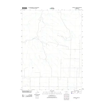
2011 Map of Lawrence Fork
USGS Topo · Published 2011About this map
Lawrence Fork winds through this section of Cheyenne County, creating a distinct drainage pattern across an otherwise open landscape of ranchlands and section roads. The map reveals the deep roots of the local community through its burial grounds, including the Bethel Cemetery, the Swedish Cemetery, and Mud Springs SW. These locations, alongside the Singleton Ranch and Horsehead Ranch, speak to the legacy of early settlers and the persistent agricultural heritage of the Nebraska plains.
Find a feature on this map
20 named features on this map. Tap any name to fly to it.
Don’t see what you’re looking for? This feature index may not catch every label — zoom into the map to look around manually.
Map Details
Editions of this 2011 Lawrence Fork Map
This is the sole edition of this map. No revisions or reprints were ever made.
Other maps of this area

1898 · Camp Clarke
USGS Topo · 1:125,000

1954 · Scottsbluff
USGS Topo · 1:250,000

1958 · Scottsbluff
USGS Topo · 1:250,000

1972 · Mud Springs SW
USGS Topo · 1:24,000

1972 · Horsehead Ranch
USGS Topo · 1:24,000

1973 · Potter 2 SW
USGS Topo · 1:24,000

1973 · Bridgeport SW
USGS Topo · 1:24,000

1973 · Potter 2 SE
USGS Topo · 1:24,000

1973 · Potter 2 NW
USGS Topo · 1:24,000
1973 · Potter 2 NE
USGS Topo · 1:24,000