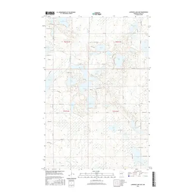
2016 Map of Lawrence Lake East
USGS Topo · Published 2016About this map
Lawrence Lake and the complex glacial basin of Itasca County define this landscape, where a dense network of water bodies is connected by the Prairie River and Balsam Cr. The terrain is characterized by a high concentration of small to medium lakes, including Kennedy Lake, Bray Lake, and the connected system of Trestle Lake and Crooked Lake. These waters have long influenced the local road network, with routes like Scenic Hwy and Co Rd 336 skirting the shorelines.
Find a feature on this map
67 named features on this map. Tap any name to fly to it.
Don’t see what you’re looking for? This feature index may not catch every label — zoom into the map to look around manually.
Map Details
Editions of this 2016 Lawrence Lake East Map
This is the sole edition of this map. No revisions or reprints were ever made.
Other maps of this area

1919 · Release
USGS Topo · 1:62,500

1920 · Trout Lake
USGS Topo · 1:62,500

1943 · Release
USGS Topo · 1:62,500

1952 · Nashwauk
USGS Topo · 1:24,000

1952 · Calumet
USGS Topo · 1:24,000

1952 · Pengilly
USGS Topo · 1:24,000

1952 · Bovey
USGS Topo · 1:24,000

1954 · Hibbing
USGS Topo · 1:250,000

1957 · Hibbing
USGS Topo · 1:250,000

1958 · Hibbing
USGS Topo · 1:250,000