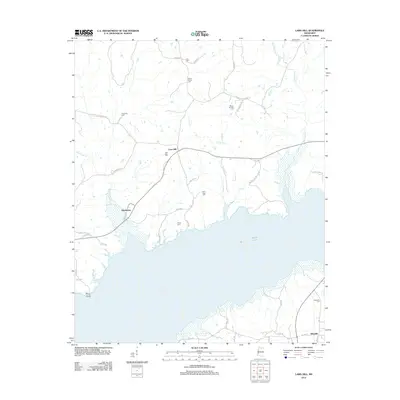
2012 Map of Laws Hill
USGS Topo · Published 2012About this map
Sardis Lake dominates the southern landscape of this northern Mississippi region, where the shoreline of the reservoir meets a network of small creeks and rural cemeteries. The community of Abbeville is situated in the southeastern corner, serving as a primary point of interest with its own Abbeville Cem and established road network including W Long St. Further north, the settlement of Laws Hill acts as a central hub for the upland areas, connected by several rural routes such as Laws Hill Rd and Law Hill Chulahoma Rd.
Find a feature on this map
47 named features on this map. Tap any name to fly to it.
Don’t see what you’re looking for? This feature index may not catch every label — zoom into the map to look around manually.
Map Details
Editions of this 2012 Laws Hill Map
This is the sole edition of this map. No revisions or reprints were ever made.
Other maps of this area

1940 · Oxford
USGS Topo · 1:62,500

1942 · Denmark
USGS Topo · 1:62,500

1943 · Denmark
USGS Topo · 1:62,500

1943 · Oxford
USGS Topo · 1:62,500

1944 · Tyro
USGS Topo · 1:62,500

1944 · Potts Camp
USGS Topo · 1:62,500

1945 · Potts Camp
USGS Topo · 1:62,500

1956 · Tupelo
USGS Topo · 1:250,000

1958 · Tupelo
USGS Topo · 1:250,000

1964 · Waterford
USGS Topo · 1:24,000