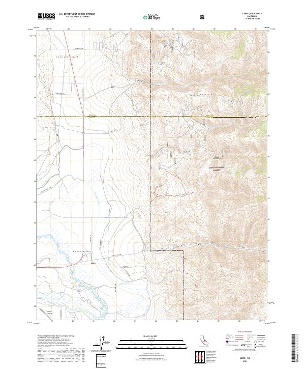
2021 Map of Laws
USGS Topo · Published 2021About this map
Owens Valley irrigation and high-altitude terrain define this 2021 study of the California landscape. The settlement of Laws serves as a focal point near the Owens River, where a network of water management features like Laws Ditch, the Geiger Canal, and the Lower McNally Canal highlight the region's historical reliance on diverted water. To the west, the Bishop Airport sits on the valley floor, while the eastern portion of the map climbs into the White Mountains and the White-Inyo Range. This transition from the flat agricultural lands of the valley to the protected wilderness of Inyo National Forest is marked by a series of steep drainages, including Silver Canyon and Coldwater Canyon. Backcountry access is documented through numerous trails and primitive roads, such as Churchill Mine Rd and 33e316 Trl, which lead into the heights above Chalfant Valley.
Find a feature on this map
46 named features on this map. Tap any name to fly to it.
Don’t see what you’re looking for? This feature index may not catch every label — zoom into the map to look around manually.
Map Details
Editions of this 2021 Laws Map
This is the sole edition of this map. No revisions or reprints were ever made.
Other maps of this area

1913 · Bishop
USGS Topo · 1:125,000

1917 · White Mountain
USGS Topo · 1:125,000

1947 · Mariposa
USGS Topo · 1:250,000

1948 · Mariposa
USGS Topo · 1:250,000

1949 · Bishop
USGS Topo · 1:62,500

1951 · Bishop
USGS Topo · 1:62,500

1951 · Blanco Mountain
USGS Topo · 1:62,500

1957 · Mariposa
USGS Topo · 1:250,000

1962 · Mt. Barcroft
USGS Topo · 1:62,500

1962 · White Mtn. Peak
USGS Topo · 1:62,500