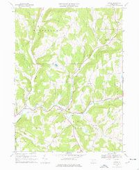
1967 Map of Lawton
USGS Topo · Published 1977About this map
The convergence of North Branch Wyalusing Creek, Middle Branch Wyalusing Creek, and East Branch Wyalusing Creek forms the hydrologic heart of this landscape in the late 1960s. Settled pockets like Lawton, Rushville, and Rush are situated along these waterways and the local road network, which includes Stonestreet Road. The topography is defined by prominent elevations such as Devine Ridge and Fowler Hill, interspersed with several active and former Quarry and Gravel Pit sites, signaling a history of local resource extraction.
Find a feature on this map
43 named features on this map. Tap any name to fly to it.
Don’t see what you’re looking for? This feature index may not catch every label — zoom into the map to look around manually.
Map Details
Editions of this 1967 Lawton Map
Other maps of this area

1943 · Montrose
USGS Topo · 1:62,500

1943 · Le Raysville
USGS Topo · 1:62,500

1945 · Montrose
USGS Topo · 1:62,500

1945 · Le Raysville
USGS Topo · 1:62,500

1945 · Meshoppen
USGS Topo · 1:62,500

1945 · Auburn Center
USGS Topo · 1:24,000

1945 · Laceyville
USGS Topo · 1:24,000

1946 · Tunkhannock
USGS Topo · 1:62,500

1946 · Springville
USGS Topo · 1:24,000
1947 · Auburn Center
USGS Topo · 1:31,680