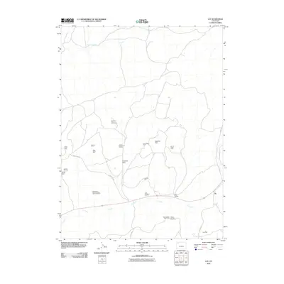
2010 Map of Lay
USGS Topo · Published 2010About this map
Lay stands as a primary settlement point in this corner of Moffat County, situated where the waters of Lay Creek wind through the high desert. The landscape is defined by its extensive history of mineral exploration and extraction, with claims and mine sites scattered across the terrain. Notable mining operations such as the Sugarloaf Mine and the Gertrude Mine are located near Sugarloaf Basin, while the Hazel Whetstone Property and various claims like the Buffalo Head Mining Company Claim Number Six highlight the area's legacy of prospecting. To the south, Lay Peak and Sugarloaf Peak provide significant relief, marking the topographic boundaries of a region largely shaped by the cattle-and-mining economy of Western Colorado. The map traces the routes of County RD 53 and County RD 17, which connect these remote resource sites to the larger regional network.
Find a feature on this map
25 named features on this map. Tap any name to fly to it.
Don’t see what you’re looking for? This feature index may not catch every label — zoom into the map to look around manually.
Map Details
Editions of this 2010 Lay Map
This is the sole edition of this map. No revisions or reprints were ever made.
Other maps of this area

1907 · White River
USGS Topo · 1:125,000

1910 · Danforth Hills
USGS Topo · 1:125,000

1910 · White River
USGS Topo · 1:125,000

1912 · Axial
USGS Topo · 1:62,500

1914 · Axial
USGS Topo · 1:62,500

1916 · Craig
USGS Topo · 1:125,000

1954 · Vernal
USGS Topo · 1:250,000

1954 · Craig
USGS Topo · 1:250,000

1957 · Craig
USGS Topo · 1:250,000

1958 · Vernal
USGS Topo · 1:250,000