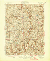
1945 Map of Le Raysville
USGS Topo · Published 1945About this map
The Pennsylvania New York State Boundary Line forms the northern edge of this rural landscape, where the border country of Bradford and Susquehanna counties is defined by a network of winding creeks and upland farms. The borough of Le Raysville sits as a central hub, surrounded by dozens of family-named crossroads and hamlets like Potterville, Neath, and Birchardville. The terrain is deeply incised by the North Branch and Middle Branch Wyalusing Creek, which drain south toward the larger Susquehanna valley. Scattered throughout these highlands are essential community markers of the mid-1940s, including St Patricks Ch and numerous small burial grounds such as Centerville Cem and Devine Ridge Cem. The map captures a moment before major highway expansion, where secondary roads connect isolated schoolhouses like Flynn Sch and Logan Hill Sch to the dairy-farming hinterland.
Find a feature on this map
78 named features on this map. Tap any name to fly to it.
Don’t see what you’re looking for? This feature index may not catch every label — zoom into the map to look around manually.
Map Details
Editions of this 1945 Le Raysville Map
2 editions found

Other maps of this area

1901 · Apalachin
USGS Topo · 1:62,500

1903 · Owego
USGS Topo · 1:62,500

1904 · Binghamton
USGS Topo · 1:62,500

1904 · Apalachin
USGS Topo · 1:62,500

1906 · Catatonk
USGS Topo · 1:125,000

1923 · Towanda
USGS Topo · 1:62,500

1926 · Towanda
USGS Topo · 1:62,500

1935 · Binghamton West
USGS Topo · 1:24,000

1942 · Binghamton West
USGS Topo · 1:31,680

1943 · Towanda
USGS Topo · 1:62,500