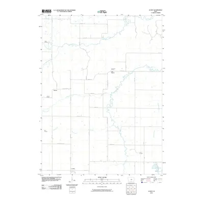
2010 Map of Le Roy
USGS Topo · Published 2010About this map
Le Roy sits near the southern edge of this Decatur County landscape, where the rural grid is defined by historical crossings and small, dispersed settlements. The area around Smyrna and Last Chance reflects the legacy of 19th-century migration, evidenced by the winding path of the Mormon Trl and Mormoan Trl cutting across the sections. Genealogists will find a significant concentration of local burial grounds, including Smyrna Cemetery, Last Chance Cemetery, Blair Cemetery, Gwinn Cemetery, and Clarke Cemetery, each marking early family settlements in the region. Waterways dictate the terrain, with the Chariton River and Chariton Creek meandering through the center, while White Breast Creek and South White Breast Creek drain the northern reaches. To the southeast, the Humeston Reservoir provides a notable local landmark near the Wayne County line, illustrating the intersection of natural drainage and modern water management in this agricultural heartland.
Find a feature on this map
40 named features on this map. Tap any name to fly to it.
Don’t see what you’re looking for? This feature index may not catch every label — zoom into the map to look around manually.
Map Details
Editions of this 2010 Le Roy Map
This is the sole edition of this map. No revisions or reprints were ever made.
Other maps of this area

1918 · Chariton
USGS Topo · 1:62,500

1934 · Humeston
USGS Topo · 1:48,000

1937 · Corydon
USGS Topo · 1:62,500

1950 · New Virginia
USGS Topo · 1:62,500

1952 · New Virginia
USGS Topo · 1:62,500

1954 · Centerville
USGS Topo · 1:250,000

1954 · Des Moines
USGS Topo · 1:250,000

1956 · Des Moines
USGS Topo · 1:250,000

1957 · Des Moines
USGS Topo · 1:250,000

1957 · Centerville
USGS Topo · 1:250,000