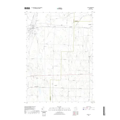
2019 Map of Le Roy
USGS Topo · Published 2019About this map
Oatka Creek carves through the northwestern corner of this landscape, anchoring the settlement of Le Roy. This territory is defined by a dense network of family and community history, evidenced by the concentration of burial grounds such as Machpelah Cem, Saint Marks Cem, and Saint Francis Cem. The terrain south of the village transitions into a grid of agricultural land and small crossroads settlements like Union Corners and Linwood. The map captures a moment where old territorial lines meet modern infrastructure, specifically where Telephone Rd and LeRoy-Caledonia Rd serve as primary arteries through the limestone-rich region. To the east, the village of Caledonia sits near the Monroe County line, while smaller locales like Limerock and York punctuate the rural stretches between the larger townships.
Find a feature on this map
80 named features on this map. Tap any name to fly to it.
Don’t see what you’re looking for? This feature index may not catch every label — zoom into the map to look around manually.
Map Details
Editions of this 2019 Le Roy Map
This is the sole edition of this map. No revisions or reprints were ever made.
Other maps of this area

1897 · Albion
USGS Topo · 1:62,500

1899 · Brockport
USGS Topo · 1:62,500

1904 · Batavia
USGS Topo · 1:62,500

1904 · Caledonia
USGS Topo · 1:62,500

1934 · Clifton
USGS Topo · 1:24,000

1935 · Churchville
USGS Topo · 1:24,000
1944 · Geneseo
USGS Topo · 1:31,680

1944 · Churchville
USGS Topo · 1:31,680

1944 · Byron
USGS Topo · 1:31,680

1944 · Stafford
USGS Topo · 1:31,680