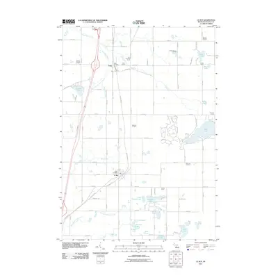
2011 Map of Le Roy
USGS Topo · Published 2011About this map
The villages of Le Roy and Tustin anchor this Osceola County landscape, where the legacy of early 20th-century logging and rail has transitioned into a region of recreational lakes and local industry. The White Pine Trl, following a former rail corridor, bisects the map vertically, connecting the two primary settlements. To the east, the Mineral Springs Oil Field indicates the subsurface resource extraction that characterizes parts of Northern Michigan. The topography is defined by numerous kettle lakes and glacial drainages, including the clusters of Little Hogback Lake, McCoy Lake, and Rose Lake. Local genealogy is well-represented through a high density of rural burial grounds, including Burdell Township Cemetery, Maple Hill Cemetery, and the Sherman Township Cemetery in the northeast corner. Small community institutions like Noggle School and Shields School provide a look at the distributed settlement pattern of the surrounding townships during this period.
Find a feature on this map
90 named features on this map. Tap any name to fly to it.
Don’t see what you’re looking for? This feature index may not catch every label — zoom into the map to look around manually.
Map Details
Editions of this 2011 Le Roy Map
This is the sole edition of this map. No revisions or reprints were ever made.
Other maps of this area

1931 · Chase NE
USGS Topo · 1:31,680

1933 · Luther SE
USGS Topo · 1:31,680

1954 · Traverse City
USGS Topo · 1:250,000

1954 · Midland
USGS Topo · 1:250,000

1957 · Cadillac South
USGS Topo · 1:62,500

1957 · Luther
USGS Topo · 1:62,500

1958 · Traverse City
USGS Topo · 1:250,000

1958 · Midland
USGS Topo · 1:250,000

1959 · Midland
USGS Topo · 1:250,000

1959 · Evart
USGS Topo · 1:62,500